How Do I Find My Property Line Before Building, Fencing, or Selling?
- Published on
- 6 min read
-
 Richard Haddad Executive EditorClose
Richard Haddad Executive Editor
Richard Haddad Executive EditorClose
Richard Haddad Executive EditorRichard Haddad is the executive editor of HomeLight.com. He works with an experienced content team that oversees the company’s blog featuring in-depth articles about the home buying and selling process, homeownership news, home care and design tips, and related real estate trends. Previously, he served as an editor and content producer for World Company, Gannett, and Western News & Info, where he also served as news director and director of internet operations.
If you’re a homeowner planning a fence, thinking about an addition, or preparing to sell, you might be wondering, “How do I find my property line?” The challenge is that property boundaries aren’t always obvious, and online maps or assumptions can be misleading or even problematic.
In this post, we provide clear and practical ways to locate your property line — from simple online options to consulting with the right professionals. Depending on your situation, one step may be enough to give you the confidence to make a move or help you avoid a dispute.
How Much Is Your Home Worth Now?
Home values have rapidly increased in recent years. How much is your current home worth now? Get a ballpark estimate from HomeLight’s free Home Value Estimator.
1. Start with your property deed
Your property deed is often the best place to begin. It contains the legal description of your land and may reference lot dimensions, boundary lines, or a recorded plat map. Some deeds may even mention landmarks, such as rock formations, large trees, or rivers and creeks that you can measure from.
While deeds don’t always spell things out in plain language, descriptions can be difficult to interpret without a map or a professional. However, they can point you to the official records that define where your property begins and ends.
If you don’t already have a copy of your deed, you can usually request one from your county recorder’s office or find it through local public records online. (See an example of a property deed.)
2. Check your local county or city property records
Many counties or municipal governments offer online assessor or Geographic Information System (GIS) mapping tools that show parcel boundaries. You may find these online search tools on your county assessor or recorder websites.
You can also search the internet using a phrase like “search property records in [county name] .gov.” By adding “.gov” to your search query, you increase the chances of finding an official government site where these services are often free.
These systems let you search by address, owner name, or parcel number, and will show lot shapes and adjacent parcels. In smaller towns or municipalities, you may need to visit department offices in person.
Note: Local county or city property records may contain maps that are not survey-accurate, and errors can occur. If you’re making decisions that require precision, such as in a legal dispute, consider hiring a licensed land surveyor (option #6 below).
3. Look for existing survey markers on your property
Your property may already have physical markers, such as metal pins, stakes, or concrete monuments, placed at lot corners during a past survey. These are often flush with the ground or buried just below the surface. A metal detector could help you find pins that have been placed on your land.
Markers can be useful clues, but they aren’t always reliable. They may have shifted, been removed, relocated, or become hard to find over time, particularly in older neighborhoods. And markers don’t always line up with existing fences or landscaping.
Before you dig for markers or make any ground intrusions or excavations, call 811 or visit call811.com to avoid unintentionally digging into an underground utility line. You can find your state’s 811 center website at 811beforeyoudig.com.
4. Review any existing property survey
If your home was surveyed when you bought it or refinanced, that document may still be valid. An official property survey provides a scaled drawing of your property lines, structures, and setbacks, making it one of the clearest ways to understand your boundaries.
Check your closing documents or ask your mortgage or title company if a survey was completed during a prior transaction. Property surveys often exist for older houses and lots.
If you are selling your home, check out HomeLight’s post: Should You Have a Property Survey At the Ready When Selling Your House. You can also see examples of residential and commercial land surveys at this link.
5. Use online maps and apps with caution
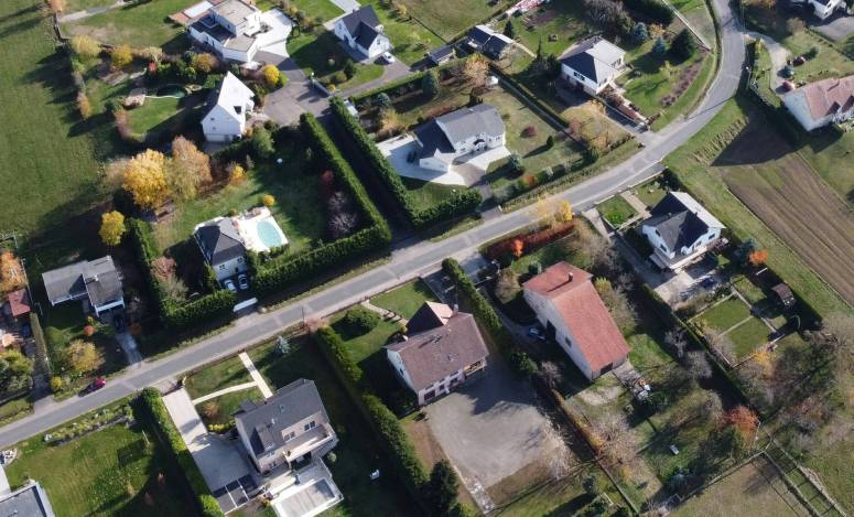
Online mapping tools, such as Google Maps, and specialty apps like LandGlide, Land ID, and Regrid, can show approximate parcel boundaries and offer impressive aerial views of your property.
However, while these tools can help you visualize your lot, they may not accurately represent your legally defined boundary lines. Satellite images and overlays often look very precise, but even small inaccuracies can translate into meaningful boundary errors on the ground.
Online maps and apps are great for orientation but not precision. If accuracy matters, treat these tools as supplemental only.
6. Hire a licensed land surveyor for confirmation
When you need certainty, such as before building a house, installing a fence, confirming a property line for a home sale, or resolving a disagreement, hiring a licensed land surveyor is the most reliable option.
A professional survey establishes your exact property lines based on legal records and on-site measurements. Angi reports that the average cost of a land survey in the U.S. is $2,300, with a normal range of $800 to $5,500. Your exact cost will depend on property size, location, terrain, time of year, and the type of survey you need.
Hiring a professional costs more than DIY research, but it provides clarity that informal methods can’t.
If questions about your property line involve a neighbor, professional documentation and opinions can quickly resolve disputes and help you avoid confrontations before they escalate.
7. Ask a local real estate agent for guidance
Local agents regularly deal with boundary questions in transactions and are familiar with available online search tools. They can help you track down and interpret plats, explain public records, and advise whether a new survey is necessary.
If you’re preparing to sell or recently bought your home, an agent’s insight can save time and prevent missteps.
Or, if you decide you’d like to pay for a professional land survey, a top local real estate agent can give you a referral to a trusted land survey company or experienced surveyor.
Yes, You Can Buy Before You Sell. Why Move Twice?
Through our Buy Before You Sell program, HomeLight can help you unlock a portion of your equity upfront to put toward your next home. You can then make a strong offer on your next home with no home sale contingency.
Choose the level of certainty that fits your situation
Your property boundaries aren’t just lines on a map; they affect usable space, setbacks, and even perceived value. Accurate property line information can help you price your home more accurately and avoid surprises during appraisal or offers.
If you’re planning casually or simply curious, public records may be enough. If you’re building, selling, or dealing with a dispute, you’ll want professional confirmation.
HomeLight can connect you with a top-rated local real estate agent who can help you answer the question: “How do I find my property line?” Our free Agent Match platform analyzes over 27 million transactions and thousands of reviews to determine which agent is best for you.
Header Image Source: (Jean Woloszczyk/ Unsplash)
At HomeLight, our vision is a world where every real estate transaction is simple, certain, and satisfying. Therefore, we promote strict editorial integrity in each of our posts.